
 French
 Deutsch
Datei:SWE-Map Rike-2008-29-07.png – Wikipedia
Es ist keine höhere Auflösung vorhanden.
SWE-Map_Rike-2008-29-07.png (277 × 594 Pixel, Dateigröße: 25 KB, MIME-Typ: image/png)
![]()
Diese Datei und die Informationen unter dem roten Trennstrich werden aus dem zentralen Medienarchiv Wikimedia Commons eingebunden.
![]()
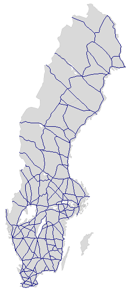
| Beschreibung | English: Sweden's network of National routes (roads), European routes within the country included. No numbers are shown. The map is based on a blank map of Sweden (Image:SWE-Map Rike.svg). For info on how to easiest edit the map see SWE-Map Documentation Svenska: Sveriges riksvägsvägnät, Europavägarna i landet inkluderade. Nummer visas ej. Kartan är baserad på en blank Sverigekarta (Image:SWE-Map Rike.svg). För information om hur kartan lättast modifieras se SWE-Map Documentation |
| Datum | (UTC) |
| Quelle | |
| Urheber |
|
| Dieses Bild wurde digital nachbearbeitet. Folgende Änderungen wurden vorgenommen: The network of national routes (riksvägar) is shown.. Das Originalbild kann hier eingesehen werden: SWE-Map Rike.svg:
|
Ich, der Urheber dieses Werkes, veröffentliche es unter der folgenden Lizenz:
Diese Datei ist unter der Creative-Commons-Lizenz „Namensnennung – Weitergabe unter gleichen Bedingungen 2.5 generisch“ (US-amerikanisch) lizenziert.
- Dieses Werk darf von dir
- verbreitet werden – vervielfältigt, verbreitet und öffentlich zugänglich gemacht werden
- neu zusammengestellt werden – abgewandelt und bearbeitet werden
- Zu den folgenden Bedingungen:
- Namensnennung – Du musst angemessene Urheber- und Rechteangaben machen, einen Link zur Lizenz beifügen und angeben, ob Änderungen vorgenommen wurden. Diese Angaben dürfen in jeder angemessenen Art und Weise gemacht werden, allerdings nicht so, dass der Eindruck entsteht, der Lizenzgeber unterstütze gerade dich oder deine Nutzung besonders.
- Weitergabe unter gleichen Bedingungen – Wenn du das Material wiedermischst, transformierst oder darauf aufbaust, musst du deine Beiträge unter der gleichen oder einer kompatiblen Lizenz wie das Original verbreiten.
Ursprüngliches Datei-Logbuch
This image is a derivative work of the following images:
- Image:SWE-Map_Rike.svg licensed with Cc-by-sa-2.5
- 2008-06-13T11:25:55Z Lokal Profil 255x580 (44016 Bytes) made the fill colour slightly darker (~15% gray)
- 2007-04-15T22:51:05Z Lokal Profil 255x580 (44016 Bytes) Inverted colours, reduced amount of white space on the sides
- 2007-04-11T23:48:00Z Lokal Profil 287x606 (44008 Bytes) Metadata correction
- 2007-04-11T23:39:36Z Lokal Profil 287x606 (44000 Bytes) {{Information |Description={{en|An outline of the national borders of Sweden. For info on how to easiest edit the map see [[:User:Lokal Profil/SWE-Map Documentation|SWE-Map Documentation]]}} {{sv|Sveriges riksgräns. För inf
Hochgeladen mit derivativeFX
Dateiversionen
Klicke auf einen Zeitpunkt, um diese Version zu laden.
| Version vom | Vorschaubild | Maße | Benutzer | Kommentar | |
|---|---|---|---|---|---|
| aktuell | 20:09, 29. Jul. 2008 | | 277 × 594 (25 KB) | Skvattram~commonswiki | {{Information |Description={{en|Sweden's network of National routes (roads), European routes within the country included. No numbers are shown. The map is based on a blank map of Sweden (Image:SWE-Map Rike.svg). For info on how to easiest edit the map see |
Dateiverwendung
Keine Seiten verwenden diese Datei.