Datei:Sumatra 2007 earthquakes map.gif – Wikipedia
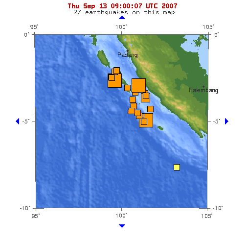
Sumatra_2007_earthquakes_map.gif (505 × 496 Pixel, Dateigröße: 30 KB, MIME-Typ: image/gif)
Dateiversionen
Klicke auf einen Zeitpunkt, um diese Version zu laden.
| Version vom | Vorschaubild | Maße | Benutzer | Kommentar | |
|---|---|---|---|---|---|
| aktuell | 10:53, 13. Sep. 2007 |  | 505 × 496 (30 KB) | TheDJ | == Summary == '''Image:''' This map shows the location of the 3 major earthquakes and it's many aftershocks off the coast of Sumatra on September 12 and September 13, 2007. It shows a total of 27 earthquakes, 25 of them in the last 24 hours. |
Dateiverwendung
Die folgende Seite verwendet diese Datei:
Globale Dateiverwendung
Die nachfolgenden anderen Wikis verwenden diese Datei:
- Verwendung auf en.wikipedia.org
- Verwendung auf id.wikipedia.org
- Verwendung auf ja.wikipedia.org
- Verwendung auf wuu.wikipedia.org
- Verwendung auf zh.wikipedia.org


 French
 Deutsch
