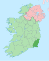
Camolin, County Wexford
This article needs additional citations for verification. (February 2020) |
Camolin Cam Eolaing | |
|---|---|
Village | |
 The R772 as Camolin Main Street | |
| Coordinates: 52°36′54″N 6°25′30″W / 52.615°N 6.425°W | |
| Country | Ireland |
| Province | Leinster |
| County | County Wexford |
| Area | |
| • Total | 1.39 km2 (0.54 sq mi) |
| Elevation | 41 m (135 ft) |
| Population (2016)[2] | 415 |
| Time zone | UTC+0 (WET) |
| • Summer (DST) | UTC-1 (IST (WEST)) |
| Irish Grid Reference | T065527 |
Camolin (Irish: Cam Eolaing)[3] is a village in County Wexford in Ireland, situated in the valley of the River Bann on the R772 regional road 6 km (3.7 mi) northeast of Ferns. As of the 2016 census, the village had a population of 415 people.[2]
Transport
[edit]Camolin railway station opened on 1 November 1867, but finally closed on 30 March 1964.[4]
Sport
[edit]The community field, situated on the Main Street, is used by two sporting clubs; Camolin Celtic AFC and St. Patrick's GAA Club.
Camolin Celtic cater for both men's and ladies' teams. They field men's and boys' teams from Under-8 level to senior, and ladies' teams at Under-10, Under-14 and senior levels.[citation needed]
St. Patrick's GAA club field both hurling and Gaelic football teams from Under-8 to Senior level.[citation needed]
People
[edit]- Conleth O'Connor (1947–1993), poet[5]
See also
[edit]References
[edit]- ^ "Map of Camolin, Wexford".
- ^ a b "Sapmap Area - Settlements - Camolin". Census 2016. Central Statistics Office. April 2016. Retrieved 21 March 2020.
- ^ "Cam Eolaing/Camolin". Placenames Database of Ireland (logainm.ie). Retrieved 19 October 2021.
- ^ "Camolin station" (PDF). Railscot - Irish Railways. Retrieved 14 September 2007.
- ^ "Conleth O'Connor". www.ricorso.net.


 French
 Deutsch

