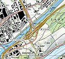
File:1150 Luzern.jpg

Original file (14,000 × 9,600 pixels, file size: 110.74 MB, MIME type: image/jpeg)

Summary

Warning The original file is very high-resolution. It might not load properly or could cause your browser to freeze when opened at full size. Open in ZoomViewer
Title
Luzern
Subtitle Malters - Emmen - Meggen
Description
Deutsch: Blatt 1150 Luzern der Landeskarte der Schweiz 1:25'000.
Français : Feuille 1150 Luzern de la Carte nationale de la Suisse 1:25 000.
English: National Map of Switzerland 1:25'000, sheet 1150 Luzern. Nota bene: this is compressed JPEG version of the original TIFF file. The map can be also consulted on the geographical portal.
Map legend
English: For explanatory notes and symbols, see Conventional signs, pp. 2–4, 12 (2023), displayed below. Lines of the Swiss grid on the 1:25'000 have a spacing of 1 km. An entire sheet covers an area of 17.5 km x 12 km: 210 square kilometres (81 sq mi).
Adjacent sheets
1130: Hochdorf
1149: Wolhusen
←+→
1151: Rigi
1170: Alpnach
Sheet index
Date
Source
Creator
institution QS:P195,Q685592
 Geotemporal data
Map location Luzern
Spatial reference system Swiss coordinate system
Scale 1:25,000
Heading
Georeferencing Georeference the map in Wikimaps Warper If inappropriate please set warp_status = skip to hide.
Swiss grid
InfoField
47°06′39″N 8°09′48″E / NW / 47.110708; 8.163283 N: 1218000 47°06′32″N 8°23′38″E / NE / 47.109024; 8.393833
2655000 E: 2672500
47°00′10″N 8°09′43″E / SW / 47.002773; 8.161827 1206000 47°00′04″N 8°23′31″E / SE / 47.001092; 8.391913
 Bibliographic data
Part of the series National Map of Switzerland 1:25'000
Map sheet 1150
Print edition
InfoField
 ISBN: 978-3-302-01150-9
Other versions
Object location47° 03′ 21.45″ N, 8° 16′ 39.77″ E Kartographer map based on OpenStreetMap.View this and other nearby images on: OpenStreetMapinfo

Licensing

The data made publicly available by swisstopo may be used, distributed and made accessible. Furthermore, they may be enriched and processed and also used commercially.

A reference to the source is mandatory. In the case of digital or analogue representations and publications, as well as in the case of dissemination, one of the following source references must be attached in any case:

  • Federal Office of Topography swisstopo
  • Bundesamt für Landestopografie swisstopo
  • Office fédéral de topographie swisstopo
  • Ufficio federale di topografia swisstopo
  • Uffizi federal da topografia swisstopo
  • ©swisstopo

Terms of use for free geodata and geoservices (OGD) from swisstopo
Frequently asked questions about free basic geodata


Deutsch | français | italiano | English | +/−

Captions

Add a one-line explanation of what this file represents

Items portrayed in this file

depicts

image/jpeg

9,600 pixel

14,000 pixel

833b357048012dd2ceac8aa709f0233d6e97a103

116,115,474 byte

47°3'21.445"N, 8°16'39.774"E

File history

Click on a date/time to view the file as it appeared at that time.

Date/TimeThumbnailDimensionsUserComment
current21:11, 12 September 2023Thumbnail for version as of 21:11, 12 September 202314,000 × 9,600 (110.74 MB)Yannc:User:Rillke/bigChunkedUpload.js: less compression
15:15, 27 March 2021Thumbnail for version as of 15:15, 27 March 202114,000 × 9,600 (21.28 MB)Zacharie GrossenUploaded a work by Bundesamt für Landestopografie swisstopo from *Original TIFF file: [https://www.swisstopo.admin.ch/en/geodata/maps/smr/smr25.html Swiss Map Raster 25] *Geographical portal: [https://map.geo.admin.ch map.geo.admin.ch] with UploadWizard

The following 2 pages use this file:

Global file usage

The following other wikis use this file: