
 French
 Deutsch
File:1856 Bauplanungen.jpg
Size of this preview: 554 × 599 pixels. Other resolutions: 222 × 240 pixels | 444 × 480 pixels | 710 × 768 pixels | 947 × 1,024 pixels | 1,479 × 1,600 pixels.
Original file (1,479 × 1,600 pixels, file size: 500 KB, MIME type: image/jpeg)
| This is a file from the Wikimedia Commons. Information from its description page there is shown below. Commons is a freely licensed media file repository. You can help. |
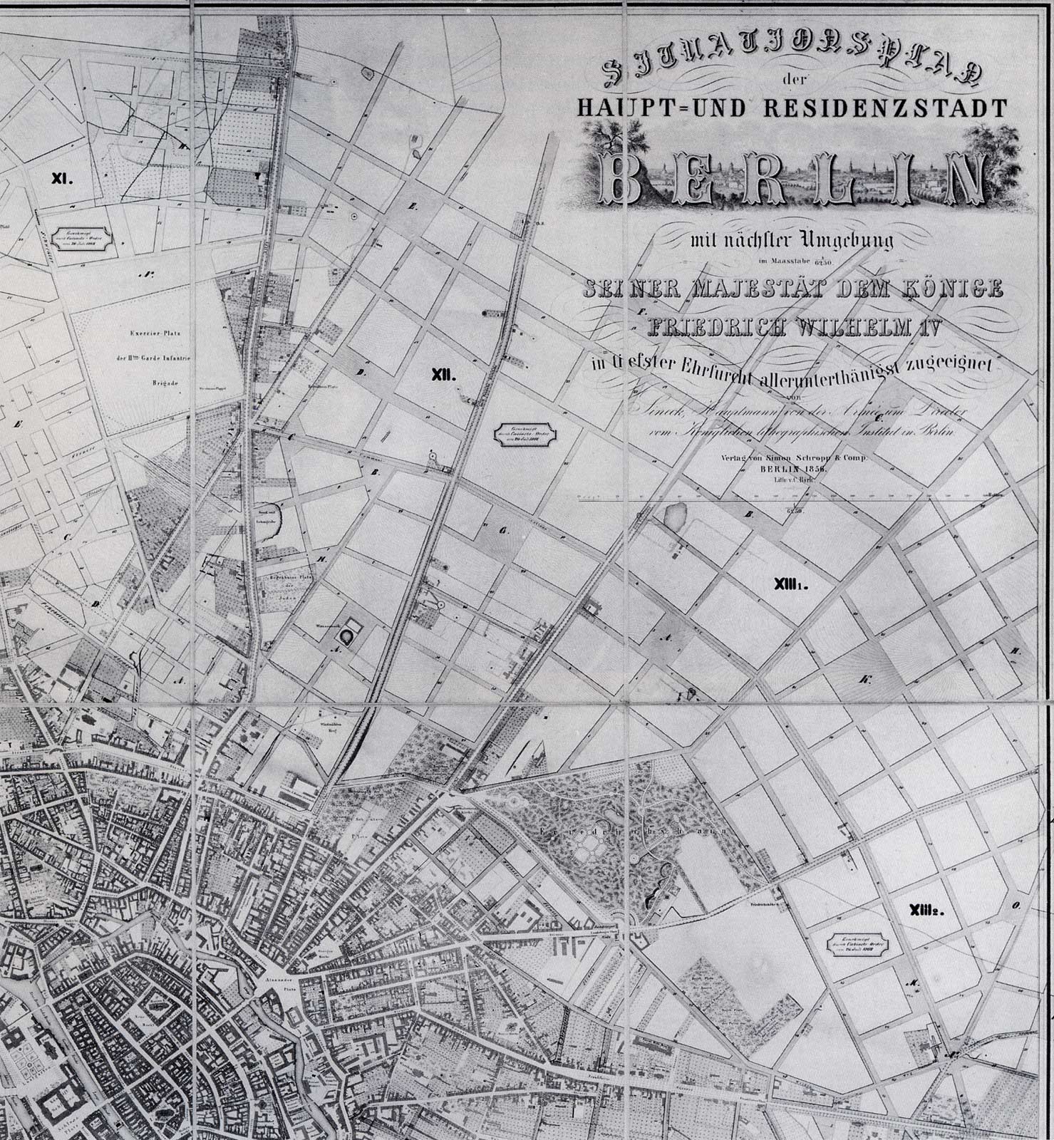
| Description | English: map of the so-called "Hobrecht plan" of the northeast of Berlins Deutsch: „Situationsplan der Haupt- und Residenzstadt Berlin mit nächster Umgebung – Bebauungsplan der Umgebungen von Berlin – Genehmigt durch Cabinets-Ordre“ | ||||
| Date | |||||
| Source | Verlag von Simon Schropp & Comp Berlin 1856 Lith v.C.Birk | ||||
| Author | Christian Thiele (APPER) | ||||
| Permission (Reusing this file) |
| ||||
File history
Click on a date/time to view the file as it appeared at that time.
| Date/Time | Thumbnail | Dimensions | User | Comment | |
|---|---|---|---|---|---|
| current | 15:05, 8 November 2005 | | 1,479 × 1,600 (500 KB) | Jcornelius | '''en:''' * Description: "Hochbrecht" plan of the northeast Berlins' * scanned by Christian Thiele (APPER) * Date: 1856 * Source: ''„Situationsplan der Haupt- und Residenzstadt Berlin mit nächster Umgebung – Bebauungsplan der U |
File usage
The following page uses this file:
Global file usage
The following other wikis use this file:
- Usage on de.wikipedia.org
- Usage on it.wikipedia.org
- Usage on sv.wikipedia.org