File:Agadez dinosaur localities.png

Size of this preview: 693 × 600 pixels. Other resolutions: 277 × 240 pixels | 555 × 480 pixels | 888 × 768 pixels | 1,184 × 1,024 pixels | 2,367 × 2,048 pixels | 2,909 × 2,517 pixels.
Original file (2,909 × 2,517 pixels, file size: 3.17 MB, MIME type: image/png)
File history
Click on a date/time to view the file as it appeared at that time.
| Date/Time | Thumbnail | Dimensions | User | Comment | |
|---|---|---|---|---|---|
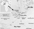
| current | 22:22, 13 April 2019 |  | 2,909 × 2,517 (3.17 MB) | FunkMonk | == {{int:filedesc}} == {{Information |Description=Map of dinosaur localities in the vicinity of Agadez, Rep. Niger. Generated with GoogleEarth MapMaker Utility 2009. |Source=https://journals.plos.org/plosone/article?id=10.1371/journal.pone.0014642 |Author=Alexander Mudroch, Ute Richter, Ulrich Joger, Ralf Kosma, Oumarou Idé, Abdoulaye Maga |Date=2011 |Permission={{cc-by-2.5}} |other_versions= }} |
File usage
The following 3 pages use this file:
Global file usage
The following other wikis use this file:
- Usage on es.wikipedia.org
- Usage on zh.wikipedia.org


 French
 Deutsch