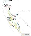
File:Central Valley Project Map from USBR 2016-07-05.jpg

Size of this preview: 526 × 599 pixels. Other resolutions: 211 × 240 pixels | 421 × 480 pixels | 674 × 768 pixels | 899 × 1,024 pixels | 2,242 × 2,553 pixels.
Original file (2,242 × 2,553 pixels, file size: 374 KB, MIME type: image/jpeg)
File history
Click on a date/time to view the file as it appeared at that time.
| Date/Time | Thumbnail | Dimensions | User | Comment | |
|---|---|---|---|---|---|
| current | 15:41, 5 July 2016 |  | 2,242 × 2,553 (374 KB) | Evx | User created page with UploadWizard |
File usage
The following page uses this file:
Global file usage
The following other wikis use this file:
- Usage on arz.wikipedia.org
- Usage on www.wikidata.org


 French
 Deutsch