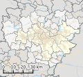
File:Katowice urban area.svg
Original file (SVG file, nominally 1,293 × 1,187 pixels, file size: 4.58 MB)
Summary polski (pl): Legenda
Zewnętrzna strefa metropolitalna
Zewnętrzna strefa metropolitalna według:
[ 2] Miasta obrzeża centralnego zespołu metropolitalnego według:
[ 1]
Granice gmin województwa śląskiego
Granice powiatów województwa śląskiego
Granica województwa śląskiego
English (en): Legend Metropolitan area according to:
[ 2] Edge of the Metropolitan area according to:
[ 1]
Borders of gminas of the Silesian voivodeship
Borders of powiats of the Silesian voivodeship
Border of the Silesian voivodeship
Licensing I, the copyright holder of this work, hereby publish it under the following license:
You are free: to share – to copy, distribute and transmit the workto remix – to adapt the work Under the following conditions: attribution – You must give appropriate credit, provide a link to the license, and indicate if changes were made. You may do so in any reasonable manner, but not in any way that suggests the licensor endorses you or your use.share alike – If you remix, transform, or build upon the material, you must distribute your contributions under the same or compatible license as the original. https://creativecommons.org/licenses/by-sa/4.0 CC BY-SA 4.0 Creative Commons Attribution-Share Alike 4.0 true true ↑ a b c Elżbieta Zuzańska-Żyśko: "Funkcje metropolitalne w Górnośląskim Obszarze Metropolitalnym" ↑ a b c Przemysław Śleszyński: "Delimitacja Miejskich Obszarów Funkcjonalnych stolic województw" English Map of Katowice urban area and its metropolitan area.
Polish Mapa konurbacji górnośląskiej i jej obszaru metropolitalnego.
File history Click on a date/time to view the file as it appeared at that time.
Date/Time Thumbnail Dimensions User Comment current 07:39, 9 April 2024 1,293 × 1,187 (4.58 MB) Dżamper Fix exclave fills 21:44, 8 April 2024 1,293 × 1,187 (4.57 MB) Dżamper Restructure SVG code to hopefully fix Wikimedia thumbnail rendering 21:39, 8 April 2024 1,293 × 1,187 (3.26 MB) Dżamper Update color scheme in accordance to Wikipedia:WikiProject Maps/Conventions/Location maps (series N) 13:28, 6 April 2024 1,293 × 1,187 (3.32 MB) Dżamper Elongate the scale bar 12:40, 6 April 2024 1,293 × 1,187 (3.31 MB) Dżamper Updated color scheme 15:24, 24 March 2024 1,276 × 921 (2.1 MB) Dżamper Add scale 08:33, 13 March 2024 1,276 × 921 (2.1 MB) Dżamper Uploaded own work with UploadWizard
File usage The following page uses this file:
Global file usage The following other wikis use this file:
Usage on pl.wikipedia.org Usage on www.wikidata.org This file contains additional information, probably added from the digital camera or scanner used to create or digitize it.
If the file has been modified from its original state, some details may not fully reflect the modified file.


 French
 Deutsch
