File:Location of Isauria-Asia Minor Map, Classical Atlas, 1886, Keith Johnston.jpg

Location_of_Isauria-Asia_Minor_Map,_Classical_Atlas,_1886,_Keith_Johnston.jpg(637 × 340 pixels, file size: 112 KB, MIME type: image/jpeg)

Description
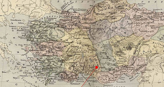
English: Asia Minor.
  • Including Pontus, Cappadocia, Cilicia, Pisidia, Lycia, Caria, Lydia, Mysia, Bithynia, Paphlagonia, Phrygia, and Crete.


  • "These color maps are 11" x 13.5" when printed at 300dpi. They were copied from an original 1886 Ginn & Company Classical Atlas designed by mapmaker Keith Johnston. These maps are completely Public Domain and can be used absolutely without restriction or even sold commercially without my permission. (There is slight distortion caused by the age of the original and merging the scans (two scans per map)" Information from http://www.snible.org/greek/
Date (UTC)
Source
Author


This is a retouched picture, which means that it has been digitally altered from its original version. Modifications: Cropping and red pointer added to show location of Isauria. The original can be viewed here: Asia Minor Map, Classical Atlas, 1886, Keith Johnston.jpg. Modifications made by Polylerus.


Public domain

This work is in the public domain in its country of origin and other countries and areas where the copyright term is the author's life plus 70 years or fewer.


You must also include a United States public domain tag to indicate why this work is in the public domain in the United States.

Original upload log

This image is a derivative work of the following images:

  • File:Asia_Minor_Map,_Classical_Atlas,_1886,_Keith_Johnston.jpg licensed with Cc-pd-mark-footer, PD-old
    • 2009-12-03T21:05:42Z Jssfrk 3669x2824 (938691 Bytes) {{Information |Description={{en|1=Asia Minor. Including Pontus, Cappadocia, Cilicia, Pisidia, Lycia, Caria, Lydia, Mysia, Bithynia, Paphlagonia, Phrygia, and Crete. "These color maps are 11" x 13.5" when printed at 300dpi. T

Uploaded with derivativeFX

Captions

Add a one-line explanation of what this file represents

Items portrayed in this file

depicts

23 January 2011

File history

Click on a date/time to view the file as it appeared at that time.

Date/TimeThumbnailDimensionsUserComment
current23:23, 23 January 2011Thumbnail for version as of 23:23, 23 January 2011637 × 340 (112 KB)Polylerus{{Information |Description={{en|1=Asia Minor. Including Pontus, Cappadocia, Cilicia, Pisidia, Lycia, Caria, Lydia, Mysia, Bithynia, Paphlagonia, Phrygia, and Crete. "These color maps are 11" x 13.5" when printed at 300dpi. They were copied from an origin
The following pages on the English Wikipedia use this file (pages on other projects are not listed):

Global file usage

The following other wikis use this file:

Metadata