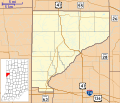
File:Locator map of Warren County, Indiana.svg

Size of this PNG preview of this SVG file: 700 × 600 pixels. Other resolutions: 280 × 240 pixels | 560 × 480 pixels | 896 × 768 pixels | 1,195 × 1,024 pixels | 2,389 × 2,048 pixels.
Original file (SVG file, nominally 896 × 768 pixels, file size: 590 KB)
File history
Click on a date/time to view the file as it appeared at that time.
| Date/Time | Thumbnail | Dimensions | User | Comment | |
|---|---|---|---|---|---|
| current | 13:28, 30 September 2012 |  | 896 × 768 (590 KB) | Omnedon | Added state-level inset map |
| 14:07, 16 September 2012 |  | 768 × 768 (250 KB) | Omnedon | == {{int:filedesc}} == {{Information |Description={{en|This is a map of Warren County, Indiana, USA which includes incorporated settlements, township borders, and major highways.}} |Source=My own work, using custom-written... | |
| 00:17, 19 August 2010 |  | 768 × 768 (185 KB) | Omnedon | == {{int:filedesc}} == {{Information |Description={{en|This is a map of Warren County, Indiana, USA which includes township borders.}} |Source=My own work, using freely-available shape data from the United States Census Bureau with a custom-written MapScr |
File usage
The following 43 pages use this file:
- Andrew Brier House
- Baltimore, Indiana
- Black Rock, Indiana
- Brisco, Indiana
- Carbondale, Indiana
- Chatterton, Indiana
- Chesapeake, Indiana
- Dresser, Indiana
- Five Points, Warren County, Indiana
- Foster, Indiana
- Glen Cliff, Indiana
- Green Hill, Indiana
- Hedrick, Indiana
- Hooker Corner, Indiana
- Independence, Indiana
- Johnsonville, Indiana
- Judyville, Indiana
- Kent and Hitchens Houses
- Kickapoo, Indiana
- Kramer, Indiana
- Locust Grove, Warren County, Indiana
- Marshfield, Indiana
- Mudlavia Springs, Indiana
- Old Town, Indiana
- Pence, Indiana
- Pine Village, Indiana
- Point Pleasant, Indiana
- Rainsville, Indiana
- Romine Corner, Indiana
- Sloan, Indiana
- State Line City, Indiana
- Stewart, Indiana
- Sycamore Corner, Indiana
- Tab, Indiana
- Van Reed Farmstead
- Walnut Grove, Warren County, Indiana
- Warren County Courthouse (Indiana)
- Warrenton, Indiana
- West Lebanon, Indiana
- Williamsport, Indiana
- Winthrop, Indiana
- Module:Location map/data/USA Indiana Warren County
- Module:Location map/data/USA Indiana Warren County/doc
Global file usage
The following other wikis use this file:
- Usage on ar.wikipedia.org
- Usage on azb.wikipedia.org
- Usage on ceb.wikipedia.org
- Usage on es.wikipedia.org
- Usage on fa.wikipedia.org
- الگو:Location map USA Indiana Warren County
- کاربوندیل، ایندیانا
- ایندیپندنس، ایندیانا
- جانسنویل، ایندیانا
- مارشفیلد، ایندیانا
- فاستر، ایندیانا
- وینتروپ، ایندیانا
- استیوارت، ایندیانا
- تب، ایندیانا
- گرین هیل، ایندیانا
- هدریک، ایندیانا
- جودیویل، ایندیانا
- کارمر، ایندیانا
- پنس، ایندیانا
- رینزویل، ایندیانا
- بالتیمور (ایندیانا)
- Usage on fr.wikipedia.org
- Usage on kn.wikipedia.org
- Usage on ro.wikipedia.org
- Usage on si.wikipedia.org
- Usage on tr.wikipedia.org
View more global usage of this file.


 French
 Deutsch