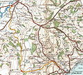
File:Map Axminster Lyme.jpg

Size of this preview: 662 × 600 pixels. Other resolutions: 265 × 240 pixels | 530 × 480 pixels | 818 × 741 pixels.
Original file (818 × 741 pixels, file size: 383 KB, MIME type: image/jpeg)
File history
Click on a date/time to view the file as it appeared at that time.
| Date/Time | Thumbnail | Dimensions | User | Comment | |
|---|---|---|---|---|---|
| current | 16:02, 3 August 2010 |  | 818 × 741 (383 KB) | Old Moonraker | As suggested byen:User:Redrose64: Scale inaccurate—grid lines at 2 mile intervals. |
| 16:00, 2 August 2010 |  | 568 × 609 (259 KB) | Old Moonraker | Added scale | |
| 14:46, 2 August 2010 |  | 568 × 609 (198 KB) | Old Moonraker | {{Information |Description=Route of en:Lyme Regis branch line. Grid line 1000 metres. Contours 50 feet. |Source=en:Ordnance Survey Scanned by Arthur Rowbottom at http://www.ponies.me.uk/maps/about.html. Colour highlighting by uploader |Date=1932 |
File usage
The following page uses this file:


 French
 Deutsch