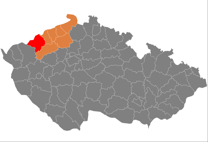
File:Map CZ - district Chomutev.PNG

Size of this preview: 800 × 548 pixels. Other resolutions: 320 × 219 pixels | 640 × 439 pixels | 1,024 × 702 pixels | 1,281 × 878 pixels.
Original file (1,281 × 878 pixels, file size: 37 KB, MIME type: image/png)
File history
Click on a date/time to view the file as it appeared at that time.
| Date/Time | Thumbnail | Dimensions | User | Comment | |
|---|---|---|---|---|---|
| current | 08:42, 5 October 2007 |  | 1,281 × 878 (37 KB) | Michiel1972 | {{Information |Description=Locator_maps_of_districts_of_the_Czech_Republic. |Source=self-made, based on Image:Czech_Republic_districts.png |Date= |Author= Michiel1972 }} [[category:Locator_maps_of_districts_of_the_Czech_Republic |
File usage
The following page uses this file:
Global file usage
The following other wikis use this file:
- Usage on ar.wikipedia.org
- Usage on azb.wikipedia.org
- Usage on bg.wikipedia.org
- Usage on de.wikipedia.org
- Usage on eo.wikipedia.org
- Usage on fa.wikipedia.org
- Usage on fr.wikipedia.org
- Usage on hu.wikipedia.org
- Usage on it.wikipedia.org
- Usage on ka.wikipedia.org
- Usage on ms.wikipedia.org
- Usage on nl.wikipedia.org
- Usage on pl.wikipedia.org
- Usage on pt.wikipedia.org
- Chomutov (distrito)
- Chomutov
- Jirkov
- Kadaň
- Predefinição:Distrito de Chomutov
- Bílence
- Blatno (Chomutov)
- Boleboř
- Březno (Ústí nad Labem)
- Chbany
- Černovice (Ústí nad Labem)
- Domašín
- Droužkovice
- Hora Svatého Šebestiána
- Hrušovany (Chomutov)
- Kalek
- Kovářská
- Kryštofovy Hamry
- Křimov
- Libědice
- Málkov (Ústí nad Labem)
- Měděnec
- Místo
- Nezabylice
- Okounov
- Otvice
- Perštejn
- Pětipsy
- Račetice
- Radonice (Ústí nad Labem)
- Rokle
- Spořice
- Strupčice
- Údlice
- Pesvice
- Veliká Ves (Ústí nad Labem)
- Vilémov (Chomutov)
View more global usage of this file.


 French
 Deutsch