
 French
 Deutsch
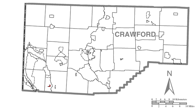
File:Map of Adamsville, Crawford County, Pennsylvania Highlighted.png

Original file (2,454 × 1,387 pixels, file size: 127 KB, MIME type: image/png)
| This is a file from the Wikimedia Commons. Information from its description page there is shown below. Commons is a freely licensed media file repository. You can help. |
Map of Crawford County, Pennsylvania, United States, with Adamsville highlighted. Derived from Image:Map of Crawford County, Pennsylvania.png, the description of which is posted below.
 | Permission is granted to copy, distribute and/or modify this document under the terms of the GNU Free Documentation License, Version 1.2 only as published by the Free Software Foundation; with no Invariant Sections, no Front-Cover Texts, and no Back-Cover Texts. A copy of the license is included in the section entitled GNU Free Documentation License. | 1.2 only |
- You are free:
- to share – to copy, distribute and transmit the work
- to remix – to adapt the work
- Under the following conditions:
- attribution – You must give appropriate credit, provide a link to the license, and indicate if changes were made. You may do so in any reasonable manner, but not in any way that suggests the licensor endorses you or your use.
- share alike – If you remix, transform, or build upon the material, you must distribute your contributions under the same or compatible license as the original.
| Description | Map of Crawford County. | |||
| Date | ||||
| Source | Source image taken from the United States Census Bureau's website pa_cosub.pdf. Image was modified by Ram-Man. | |||
| Author | (c)2006 Derek Ramsey (Ram-Man) (from U.S. Census Bureau source) | |||
| Permission (Reusing this file) | A United States Census Bureau / Government work is in the public domain, however, my modifications are licensed as follows: You may NOT use this image on your own web site or anywhere else unless you release this image and any derivative works (e.g. your web site) by following the terms of one of the following licenses. Any other use will be considered a breach of copyright and I reserve the right of legal action. If you have not read the terms of these licenses or do not understand them, then do not use this image. I, the copyright holder of this work, hereby publish it under the following licenses:
This file is licensed under the Creative Commons Attribution-Share Alike 2.5 Generic, 2.0 Generic and 1.0 Generic license.
You may select the license of your choice. | |||
| Other versions | Image:Map of Crawford County, Pennsylvania No Text.png - Version without text |
File history
Click on a date/time to view the file as it appeared at that time.
| Date/Time | Thumbnail | Dimensions | User | Comment | |
|---|---|---|---|---|---|
| current | 20:29, 20 April 2007 | | 2,454 × 1,387 (127 KB) | Nyttend | Map of {{w|Crawford County, Pennsylvania|Crawford County}}, {{w|Pennsylvania}}, {{w|United States}}, with {{w|Adamsville, Pennsylvania|Adamsville}} highlighted. Derived from Image:Map of Crawford County, Pennsylvania.png, the description of which is |
File usage
Global file usage
The following other wikis use this file:
- Usage on azb.wikipedia.org
- Usage on es.wikipedia.org
- Usage on fa.wikipedia.org
- Usage on fr.wikipedia.org
- Usage on ha.wikipedia.org
- Usage on tt.wikipedia.org
- Usage on www.wikidata.org