
 French
 Deutsch
File:Soure freguesias 2013.svg

Size of this PNG preview of this SVG file: 686 × 599 pixels. Other resolutions: 275 × 240 pixels | 550 × 480 pixels | 879 × 768 pixels | 1,172 × 1,024 pixels | 2,345 × 2,048 pixels | 2,576 × 2,250 pixels.
Original file (SVG file, nominally 2,576 × 2,250 pixels, file size: 359 KB)
| This is a file from the Wikimedia Commons. Information from its description page there is shown below. Commons is a freely licensed media file repository. You can help. |
Summary
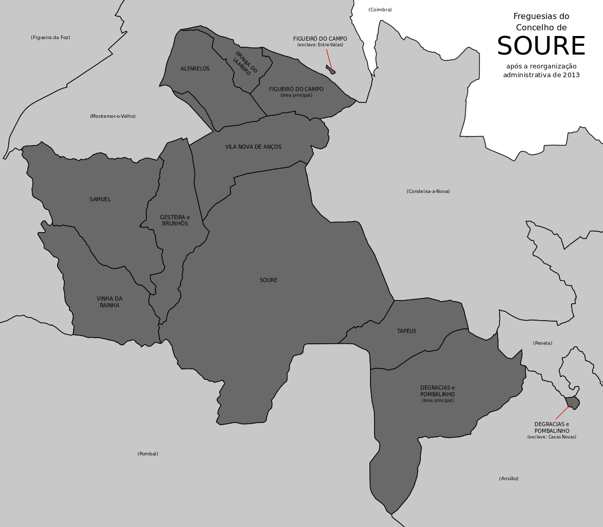
| Description | Português: Freguesias do concelho de Soure (Portugal) Fontes:
English: Civil parishes in the municipality of Soure (Portugal) Sources:
|
| Date | |
| Source | Own work |
| Author | Gazilion |
Licensing
I, the copyright holder of this work, hereby publish it under the following license:
| This file is made available under the Creative Commons CC0 1.0 Universal Public Domain Dedication. | |
| The person who associated a work with this deed has dedicated the work to the public domain by waiving all of their rights to the work worldwide under copyright law, including all related and neighboring rights, to the extent allowed by law. You can copy, modify, distribute and perform the work, even for commercial purposes, all without asking permission.
|
File history
Click on a date/time to view the file as it appeared at that time.
| Date/Time | Thumbnail | Dimensions | User | Comment | |
|---|---|---|---|---|---|
| current | 23:55, 13 May 2014 | | 2,576 × 2,250 (359 KB) | Gazilion | * Boundaries according to Direcção-Geral do Território's CAOP 2013 * Neighbouring municipalities included |
| 19:33, 4 December 2013 |  | 3,972 × 3,475 (129 KB) | Gazilion | Added gray filling for clarity | |
| 21:48, 2 August 2013 |  | 3,972 × 3,475 (110 KB) | Gazilion | User created page with UploadWizard |
File usage
The following page uses this file:
Global file usage
The following other wikis use this file:
- Usage on eo.wikipedia.org
- Usage on it.wikipedia.org
- Usage on pt.wikipedia.org
- Usage on zh.wikipedia.org