Bethesda Trolley Trail
| Bethesda Trolley Trail | |
|---|---|
 | |
| Length | 5.9 mi (9.5 km) |
| Location | Montgomery County, Maryland |
| Use | Walking, Jogging, Biking |
| Difficulty | Easy, level, ADA accessible |
| Season | Year-round |
| Months | Year-round |
| Surface | Asphalt |
The Bethesda Trolley Trail, at one time known as the North Bethesda Trail, is a 5.9-mile (9.5 km) rail trail in southern Montgomery County, Maryland. It runs from Bouic Avenue next to the Twinbrook Metro Station in the city of Rockville to Battery Lane Park in Bethesda.[1][2]
The trail runs primarily on the abandoned right-of-way of the streetcar line that connected Bethesda to Rockville, but also partially on roads, sidewalks, and side paths.
History
[edit]In 1891, the Tennallytown (Tenleytown) and Rockville Railroad began operations along a line that came north to Bethesda on Wisconsin Avenue, turned left on Old Georgetown Road, and terminated at Bethesda Park, a 50-acre amusement park built by the railroad on the west side of Old Georgetown Road between the modern-day streets of Cedar and Greentree Road.[3][4] By 1900, the Washington and Rockville Electric Railway had laid tracks from the T&R's terminus to Rockville, though full operation would begin only in 1904.[5][6] Streetcars stopped running to Rockville in 1935, when the service was converted to buses.[7] Some of the right-of-way then sat fallow for decades.
Building a trail on the unused part of the right-of-way was first suggested in Montgomery County's 1978 Countywide Bikeways Master Plan. Design of the trail began in the early 1990s. Construction was held up for many years by opposition from neighbors and lack of funding.[8] Funding for the bridges over I-495 and I-270 was approved in 1999.[9]
Construction of the trail began in fall of 2000 and lasted nearly a decade.[10][11][12] Money to rebuild existing sections of the trail was diverted to the Forest Glen Metro overpass project, delaying work on the trail. Work was further delayed by the bridge fabrication.[12][13] Bridges over I-495 and I-270 opened in 2002 and 2003 respectively, adding to narrow, discontinuous sections that existed before 2002 between Nicholson Lane and Beech Avenue.[14][15] Paving and building the missing trail segments from the Old Georgetown Pike/Cedar Lane intersection to the intersection of Randolph Road with Rockville Pike began in November 2005, and continued into 2006.[16] Between Charles Street and Cedar Lane and north of Nicholson Lane, the trail was on sidewalks. Around the same time, the National Institutes of Health (NIH) built a trail along the south edge of their facility, which connected Rugby Avenue to the sidewalk along Old Georgetown Road. In 2008, the new sections of the trail, including the sidewalks, received signage.[17] As part of the Montrose Parkway West project in 2009, a section of trail — a side path along Rockville Pike — was constructed from Per Sei Place to Hubbard Drive, north of the North Bethesda Metro Station. That section connected to a path built along Montrose Parkway at the same time.
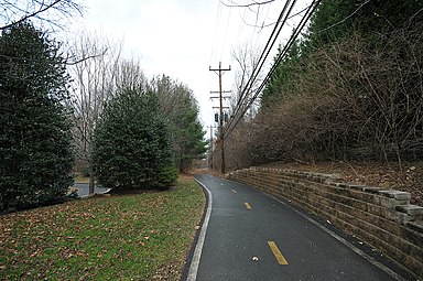
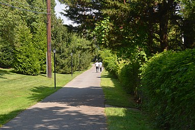
- Bethesda Trolley Trail
- Marker at the start of the Bethesda Trolley Trail
- Bethesda Trolley Trail along Old Georgetown Road in Bethesda
- Bethesda Trolley Trail at Montgomery Drive
- Bethesda Trolley Trail near Georgetown Preparatory School in North Bethesda
- Bethesda Trolley Trail at Edson Ln and Woodglen Drive in North Bethesda
39°0′56″N 77°6′43″W / 39.01556°N 77.11194°W
References
[edit]- ^ "Bethesda Trolley Trail" (PDF). Rockville, MD: Montgomery County Department of Transportation (MCDOT). 2009. Brochure.
- ^ "Bethesda Trolley Trail Map" (PDF). MCDOT. 2009.
- ^ Hopkins, G.H. (1894). "The vicinity of Washington, D.C." Library of Congress, Washington, D.C. 20540 USA. Archived from the original on 2023-09-06. Retrieved 2023-09-06.
- ^ Allman, William G. (August 1991). "Bethesda Park: "The Handsomest Park in the United States"" (PDF). The Montgomery County Story. 34 (3). Archived (PDF) from the original on 2023-09-06. Retrieved 2023-09-06.
- ^ "The Trolley Era in Rockville, 1900-1935". Peerless Rockville. November 2002. Archived from the original on 2023-08-18. Retrieved 2023-09-06.
- ^ MacMaster, Richard Kerwin; Hiebert, Ray Eldon (1996-11-01). A Grateful Remembrance: The Story of Montgomery County, Maryland. Innovation Game. p. 224. ISBN 978-0-9643819-8-8. Archived from the original on 2024-02-07. Retrieved 2023-09-06.
- ^ "Then & Now: Tenallytown & Rockville Pike Trolley Line". Reed Brothers Dodge History 1915 – 2012. 2022-05-15. Archived from the original on 2023-08-28. Retrieved 2023-08-28.
- ^ Saffir, Barbara A. (19 June 1997). "Bethesda Neighbors seek detour for bike trail". The Washington Post.
- ^ "Trail to Get Bridges for Beltway, I-270". The Washington Post. 1 December 1999.
- ^ Otto, Mary (17 August 2000). "For Bicyclists, an Easier Commute; Expanded Path Network, Loaner Program Planned". The Washington Post.
- ^ Schaffer, Ron (2 November 2000). "Out-of-Sequence Traffic Signals Frustrate Route 29 Commuter". The Washington Post.
- ^ a b "North Bethesda Trail Aug 2001 Status". Archived from the original on 24 August 2001. Retrieved 4 June 2020.
- ^ "I-495 North Bethesda Bridge August 2002". Archived from the original on 23 August 2002. Retrieved 4 June 2020.
- ^ "North Bethesda I-495 Bridge". Archived from the original on 9 May 2003. Retrieved 4 June 2020.
- ^ "North Bethesda Trail Bridge over 270". Archived from the original on 4 August 2003. Retrieved 9 June 2020.
- ^ "The North Bethesda Trolley Trail". Montgomery County Department of Public Works and Transportation (MCDPWT). Archived from the original on 10 August 2006.
- ^ "Projects Underway, Coming Up and Completions". MCDPWT. March 2008. Archived from the original on 23 May 2008.
External links
[edit]- The Bethesda Trolley Trail - Video by MCDOT


 French
 Deutsch


