Heinsdorfergrund — Wikipédia
| Heinsdorfergrund | |
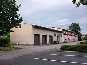
 Mairie dans l'ancienne gare d'Oberheinsdorf | |
 Armoiries | |
| Administration | |
|---|---|
| Pays | |
| Land | |
| District (Regierungsbezirk) | District de Chemnitz |
| Arrondissement (Landkreis) | Arrondissement du Vogtland |
| Code postal | 08468 |
| Indicatif téléphonique | 037600 et 03765 |
| Immatriculation | V |
| Démographie | |
| Population | 1 945 hab. () |
| Densité | 89 hab./km2 |
| Géographie | |
| Coordonnées | 50° 37′ 20″ nord, 12° 22′ 20″ est |
| Altitude | 380 m |
| Superficie | 2 186 ha = 21,86 km2 |
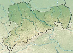
| Localisation | |
| Liens | |
| Site web | www.heinsdorfergrund-vogtland.de |
| modifier | |
Heinsdorfergrund (en allemand : /ˈhaɪ̯nsdɔʁfɐˌɡʁʊnt/[1], ![]() ? Écouter [Fiche]) est une commune de Saxe (Allemagne), située dans l'arrondissement du Vogtland, dans le district de Chemnitz.
? Écouter [Fiche]) est une commune de Saxe (Allemagne), située dans l'arrondissement du Vogtland, dans le district de Chemnitz.
Références
[modifier | modifier le code]- Prononciation en allemand standard retranscrite selon la norme API.


 French
 Deutsch

