Ludwigshöhe (Allemagne) — Wikipédia
| Ludwigshöhe | |||
 | |||
 Armoiries | |||
| Administration | |||
|---|---|---|---|
| Pays | |||
| Land | |||
| Arrondissement (Landkreis) | Mayence-Bingen | ||
| Bourgmestre (Ortsbürgermeister) | Brigitte Sprenger | ||
| Code postal | 55278 | ||
| Code communal (Gemeindeschlüssel) | 07 3 39 035 | ||
| Indicatif téléphonique | 06249 | ||
| Immatriculation | MZ | ||
| Démographie | |||
| Population | 550 hab. () | ||
| Densité | 184 hab./km2 | ||
| Géographie | |||
| Coordonnées | 49° 49′ 00″ nord, 8° 20′ 36″ est | ||
| Altitude | 86 m | ||
| Superficie | 299 ha = 2,99 km2 | ||
| Localisation | |||
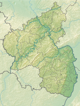
| Géolocalisation sur la carte : Allemagne Géolocalisation sur la carte : Rhénanie-Palatinat | |||
| Liens | |||
| Site web | www.ludwigshoehe.de | ||
| modifier | |||
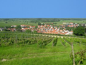
Ludwigshöhe est une municipalité de la Verbandsgemeinde Guntersblum, dans l'arrondissement de Mayence-Bingen, en Rhénanie-Palatinat, dans l'ouest de l'Allemagne.
Illustrations
[modifier | modifier le code]- VLocalisation de Ludwigshöhe dans la Verbandsgemeide et dans l'arrondissement


 French
 Deutsch


