Fájl:Kerala locator map.svg – Wikipédia

Ennek a(z) SVG fájlnak ezen PNG formátumú előnézete: 494 × 600 képpont. További felbontások: 198 × 240 képpont | 395 × 480 képpont | 632 × 768 képpont | 843 × 1 024 képpont | 1 687 × 2 048 képpont | 1 340 × 1 627 képpont.
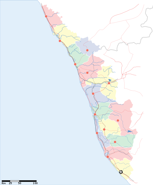
Eredeti fájl (SVG fájl, névlegesen 1 340 × 1 627 képpont, fájlméret: 151 KB)
Fájltörténet
Kattints egy időpontra, hogy a fájl akkori állapotát láthasd.
| Dátum/idő | Bélyegkép | Felbontás | Feltöltő | Megjegyzés | |
|---|---|---|---|---|---|
| aktuális | 2007. április 13., 15:53 |  | 1 340 × 1 627 (151 KB) | Planemad | correcting crop |
| 2007. április 13., 15:52 |  | 1 591 × 1 975 (152 KB) | Planemad | ||
| 2007. április 9., 19:09 |  | 1 323 × 1 607 (68 KB) | Planemad | {{WikiProject_India_Maps |Title=Kerala locator map |Description=Locator map for the state of [w:Kerala]] |Source= [http://keralapolice.org/map/keralamap.html Kerala Police - Map of Kerala], |Date=April 2007 |Author=w:user:Planemad }} [[Category:Wiki |
Fájlhasználat
Ezt a fájlt nem használja egyetlen lap sem.
Globális fájlhasználat
A következő wikik használják ezt a fájlt:
- Használata itt: awa.wikipedia.org
- Használata itt: bo.wikipedia.org
- Használata itt: de.wikipedia.org
- Használata itt: dv.wikipedia.org
- Használata itt: es.wikipedia.org
- Használata itt: fa.wikipedia.org
- Használata itt: gd.wikipedia.org
- Használata itt: gu.wikipedia.org
- Használata itt: hi.wikipedia.org
- कोल्लम जिला
- मुन्नार
- मालाबार
- कोवलम
- पुथूर
- कुमारकोम
- साँचा:केरल के लोकसभा निर्वाचन क्षेत्र
- मलप्पुरम लोक सभा निर्वाचन क्षेत्र
- आलप्पुष़ा लोक सभा निर्वाचन क्षेत्र
- आलत्तूर लोक सभा निर्वाचन क्षेत्र
- आट्टिंगल लोक सभा निर्वाचन क्षेत्र
- चालकुडी लोक सभा निर्वाचन क्षेत्र
- एर्णाकुलम लोक सभा निर्वाचन क्षेत्र
- इदुक्की लोक सभा निर्वाचन क्षेत्र
- कन्नूर लोक सभा निर्वाचन क्षेत्र
- कासरगोड लोक सभा निर्वाचन क्षेत्र
- कोल्लम लोक सभा निर्वाचन क्षेत्र
- कोट्टयम लोक सभा निर्वाचन क्षेत्र
- कोष़िक्कोड लोक सभा निर्वाचन क्षेत्र
- मावेलिक्करा लोक सभा निर्वाचन क्षेत्र
- वयनाड लोक सभा निर्वाचन क्षेत्र
- पालक्काड लोक सभा निर्वाचन क्षेत्र
- पत्तनमतिट्टा लोक सभा निर्वाचन क्षेत्र
- पोन्नानी लोक सभा निर्वाचन क्षेत्र
- तिरुवनन्तपुरम लोक सभा निर्वाचन क्षेत्र
- त्रिश्शूर लोक सभा निर्वाचन क्षेत्र
- वडकरा लोक सभा निर्वाचन क्षेत्र
- केरल के मुख्यमंत्रियों की सूची
- Használata itt: incubator.wikimedia.org
- Használata itt: mai.wikipedia.org
- Használata itt: ml.wikipedia.org
A fájl globális használatának megtekintése


 French
 Deutsch