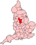
South Derbyshire
| Niet-metropolitaans district in Engeland | |||
|---|---|---|---|
  | |||
| Situering | |||
| Land | Engeland | ||
| County | Derbyshire | ||
| Regio | East Midlands | ||
| Coördinaten | 52°48'0"NB, 1°32'0"WL | ||
| Algemeen | |||
| Oppervlakte | 338,1289[1] km² | ||
| Inwoners (2018[2]) | 104.493 (309 inw./km²) | ||
| Hoofdplaats ONS-code | Swadlincote E07000039 | ||
| Website | www | ||
| Detailkaart | |||
 | |||
| |||
South Derbyshire is een Engels district in het shire-graafschap (non-metropolitan county OF county) Derbyshire en telt 104.000 inwoners. De oppervlakte bedraagt 338 km². Hoofdplaats is Swadlincote
Van de bevolking is 14,5% ouder dan 65 jaar. De werkloosheid bedraagt 2,3% van de beroepsbevolking (cijfers volkstelling 2001).
Plaatsen in district South Derbyshire
[bewerken | brontekst bewerken]Civil parishes in district South Derbyshire
[bewerken | brontekst bewerken]Ash, Aston upon Trent, Barrow upon Trent, Barton Blount, Bearwardcote, Bretby, Burnaston, Calke, Castle Gresley, Catton, Cauldwell, Church Broughton, Coton in the Elms, Dalbury Lees, Drakelow, Egginton, Elvaston, Etwall, Findern, Foremark, Foston and Scropton, Hartshorne, Hatton, Hilton, Hoon, Ingleby, Linton, Lullington, Marston on Dove, Melbourne, Netherseal, Newton Solney, Osleston and Thurvaston, Overseal, Radbourne, Repton, Rosliston, Shardlow and Great Wilne, Smisby, Stanton by Bridge, Stenson Fields, Sutton on the Hill, Swarkestone, Ticknall, Trusley, Twyford and Stenson, Walton upon Trent, Weston upon Trent, Willington, Woodville.
- ↑ Office for National Statistics → Download → SAM_for_Administrative_Areas_(2018).zip → SAM_LAD_DEC_2018_UK.xlsx.
- ↑ https://www.ons.gov.uk/file?uri=/peoplepopulationandcommunity/populationandmigration/populationestimates/datasets/populationestimatesforukenglandandwalesscotlandandnorthernireland/mid20182019laboundaries/ukmidyearestimates20182019ladcodes.xls Schatting Office for National Statistics: knop MYE5 → kolom Estimated Population mid-2018]


 French
 Deutsch