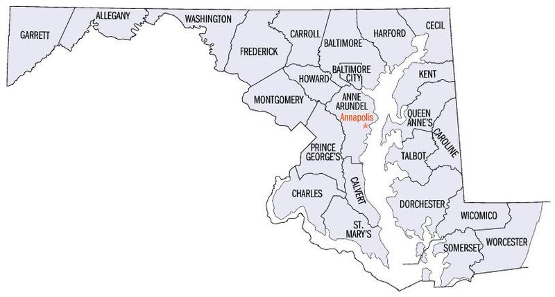
Fișier:Map of maryland counties.jpg

Mărimea acestei previzualizări: 800 × 429 pixeli. Alte rezoluții: 320 × 171 pixeli | 814 × 436 pixeli.
Mărește rezoluția imaginii (814 × 436 pixeli, mărime fișier: 43 KB, tip MIME: image/jpeg)
Istoricul fișierului
Apăsați pe Data și ora pentru a vedea versiunea trimisă atunci.
| Data și ora | Miniatură | Dimensiuni | Utilizator | Comentariu | |
|---|---|---|---|---|---|
| actuală | 16 iulie 2006 22:36 |  | 814x436 (43 KB) | JosN | Map of Maryland counties Used at English wikipedia category:Maps of Maryland |
Utilizarea fișierului
Următoarele pagini conțin această imagine:
Utilizarea globală a fișierului
Următoarele alte proiecte wiki folosesc acest fișier:
- Utilizare la ca.wikipedia.org
- Utilizare la cy.wikipedia.org
- Utilizare la en.wikipedia.org
- Utilizare la es.wikipedia.org
- Utilizare la fi.wikipedia.org
- Utilizare la fr.wikipedia.org
- Utilizare la he.wikipedia.org
- Utilizare la hi.wikipedia.org
- Utilizare la hy.wikipedia.org
- Utilizare la id.wikipedia.org
- Utilizare la it.wikipedia.org
- Utilizare la ja.wikipedia.org
- Utilizare la kn.wikipedia.org
- Utilizare la ko.wikipedia.org
- Utilizare la la.wikipedia.org
- Utilizare la nds.wikipedia.org
- Utilizare la ru.wikipedia.org
- Utilizare la simple.wikipedia.org
- Utilizare la sq.wikipedia.org
- Utilizare la tr.wikipedia.org
- Utilizare la ur.wikipedia.org


 French
 Deutsch


