Kammerberg (Fahrenzhausen) - Simple English Wikipedia, the free encyclopedia
Kammerberg | |
|---|---|
Ortsteil of Fahrenzhausen | |
| Coordinates: 48°22′19″N 11°31′1″E / 48.37194°N 11.51694°E | |
| Country | Germany |
| State | Bavaria |
| District | Freising |
| Municipality | Fahrenzhausen |
| Elevation | 480 m (1,570 ft) |
| Population (2011)[1] | |
| • Total | 580 |
| Time zone | UTC+01:00 (CET) |
| • Summer (DST) | UTC+02:00 (CEST) |
| Postal codes | 85777 |
| Dialling codes | 08137 |
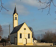
Kammerberg is village within the municipality of Fahrenzhausen in the district of Freising (Upper Bavaria), Germany.

Geography
[change | change source]Kammerberg is surrounded by the neighboring villages of Gramling, Giebing, Kollbach, Weißling, Lauterbach, Bachenhausen and Viehbach. The B13 runs about one kilometer east of Kammerberg. The Kammerberger Forest, locally called 'Hiakl', connects to the south. The Rettenbach creek flows west of Kammerberg. The area is surrounded by forests, streams and agricultural farmland.
References
[change | change source]- ↑ Kammerberg, citypopulation.de, accessed 2 November 2021.


 French
 Deutsch

