Lubbeek - Simple English Wikipedia, the free encyclopedia
Lubbeek | |
|---|---|
 | |
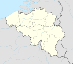
| Coordinates: 50°52′54″N 04°50′29″E / 50.88167°N 4.84139°E | |
| Country | Belgium |
| Community | Flemish Community |
| Region | Flemish Region |
| Province | Flemish Brabant |
| Arrondissement | Leuven |
| Government | |
| • Mayor | Theo Francken (N-VA) |
| • Governing party/ies | NV-A, CD&V, Lubbeek Leeft |
| Area | |
| • Total | 45.28 km2 (17.48 sq mi) |
| Population (2018-01-01)[1] | |
| • Total | 14,393 |
| • Density | 320/km2 (820/sq mi) |
| Postal codes | 3210-3212 |
| Area codes | 016 |
| Website | www.lubbeek.be |
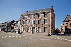
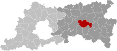
Lubbeek is a municipality in the Belgian province of Flemish Brabant.
In 2007, 13,740 people lived there.[2]
It is at 50° 52 North, 04° 50 East.[3]
References
[change | change source]- ↑ "Wettelijke Bevolking per gemeente op 1 januari 2018". Statbel. Retrieved 9 March 2019.
- ↑ "Werkelijke bevolking per gemeente op 1 januari 2007 / Population de droit par commune au 1 janvier 2007 (.xls)". Archived from the original on 2009-02-06. Retrieved 2008-07-15.
- ↑ "Geografische coördinaten van de gemeenten (.xls)". Archived from the original on 2008-11-24. Retrieved 2008-07-15.


 French
 Deutsch


