Nanticoke, Pennsylvania - Simple English Wikipedia, the free encyclopedia
Nanticoke, Pennsylvania | |
|---|---|
 Aerial view of Nanticoke | |
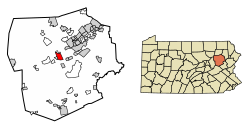
 Location of Nanticoke in Luzerne County, Pennsylvania | |
Location of Nanticoke in Pennsylvania | |
| Coordinates: 41°11′58″N 75°59′57″W / 41.19944°N 75.99917°W | |
| Country | United States |
| State | Pennsylvania |
| County | Luzerne |
| Settled | 1800 |
| Incorporated (borough) | 1874 |
| Incorporated (city) | 1926 |
| Government | |
| • Type | City Council |
| Area | |
| • Total | 3.55 sq mi (9.20 km2) |
| • Land | 3.46 sq mi (8.95 km2) |
| • Water | 0.10 sq mi (0.25 km2) |
| Elevation | 696 ft (212 m) |
| Population | |
| • Total | 10,628 |
| • Density | 3,074.34/sq mi (1,186.90/km2) |
| Time zone | UTC-5 (Eastern (EST)) |
| • Summer (DST) | UTC-4 (EDT) |
| Zip Code | 18634 |
| Area code | 570 |
| FIPS code | 42-52584 |
| Website | www |
Nanticoke is a city in Luzerne County, Pennsylvania, United States. As of the 2020 census, 10,628 people lived here.[2]
References
[change | change source]- ↑ "ArcGIS REST Services Directory". United States Census Bureau. Retrieved October 12, 2022.
- ↑ 2.0 2.1 "QuickFacts: Nanticoke city, Pennsylvania". United States Census Bureau. Retrieved September 11, 2023.


 French
 Deutsch

