Neuchâtel - Simple English Wikipedia, the free encyclopedia
Neuchâtel | |
|---|---|
| Coordinates: 46°59′N 6°56′E / 46.983°N 6.933°E | |
| Country | Switzerland |
| Canton | Neuchâtel |
| District | Neuchâtel |
| Government | |
| • Mayor | Antoine Grandjean |
| Area | |
| • Total | 18.05 km2 (6.97 sq mi) |
| Elevation | 430 m (1,410 ft) |
| Population (31 December 2018)[2] | |
| • Total | 33,475 |
| • Density | 1,900/km2 (4,800/sq mi) |
| Time zone | UTC+01:00 (Central European Time) |
| • Summer (DST) | UTC+02:00 (Central European Summer Time) |
| Postal code(s) | 2000 |
| SFOS number | 6458 |
| Surrounded by | Auvernier, Boudry, Chabrey (VD), Colombier, Cressier, Cudrefin (VD), Delley-Portalban (FR), Enges, Fenin-Vilars-Saules, Hauterive, Peseux, Saint-Blaise, Savagnier, Valangin |
| Twin towns | Aarau (Switzerland), Besançon (France), Sansepolcro (Italy) |
| Website | www SFSO statistics |
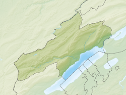
Neuchâtel is a city in Switzerland. It is the capital of Canton of Neuchâtel. As of 2003, the city had a population of 31,571 people. On 1 January 2021, the former municipalities of Corcelles-Cormondrèche, Peseux and Valangin merged to form the municipality of Neuchâtel.[3]
Gallery
[change | change source]- Lake Neuchâtel, seen from the castle
- Neuchâtel seen from the lake
- The statue of the justice fountain
References
[change | change source]- ↑ 1.0 1.1 "Arealstatistik Standard - Gemeinden nach 4 Hauptbereichen". Federal Statistical Office. Retrieved 13 January 2019.
- ↑ "Ständige Wohnbevölkerung nach Staatsangehörigkeitskategorie Geschlecht und Gemeinde; Provisorische Jahresergebnisse; 2018". Federal Statistical Office. 9 April 2019. Retrieved 11 April 2019.
- ↑ "Applikation der Schweizer Gemeinden". bfs.admin.ch. Swiss Federal Statistical Office. 2021. Retrieved 21 January 2021.
Other websites
[change | change source]![]() Media related to Neuchâtel at Wikimedia Commons
Media related to Neuchâtel at Wikimedia Commons
- City of Neuchâtel official website (in French)


 French
 Deutsch


