Pfronten - Simple English Wikipedia, the free encyclopedia
Pfronten | |
|---|---|
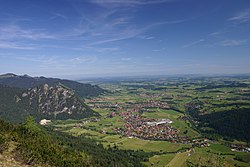
 Aerial view | |
| Coordinates: 47°35′N 10°33′E / 47.583°N 10.550°E | |
| Country | Germany |
| State | Bavaria |
| Admin. region | Schwaben |
| District | Ostallgäu |
| Government | |
| • Mayor (2020–26) | Alfons Haf[1] |
| Area | |
| • Total | 62.22 km2 (24.02 sq mi) |
| Elevation | 853 m (2,799 ft) |
| Population (2022-12-31)[2] | |
| • Total | 8,443 |
| • Density | 140/km2 (350/sq mi) |
| Time zone | UTC+01:00 (CET) |
| • Summer (DST) | UTC+02:00 (CEST) |
| Postal codes | 87459 |
| Dialling codes | 08363 |
| Vehicle registration | OAL |
| Website | www.pfronten.de |
Pfronten (Swabian: Pfronte) is a municipality in Ostallgäu in Bavaria in Germany.
Geography
[change | change source]Pfronten is one of a total of 45 towns, markets and municipalities in Ostallgäu.
Pfronten is on the northern edge of the Allgäu Alps. The Vils flows through the municipal territory. It is at an altitude of 853 m above sea level. NN at the foot of Edelsberg, Kienberg, Breitenberg and Falkenstein. The highest point of the municipality is the peak of the Aggenstein (1986 m above sea level) on the Tyrolean border, which belongs to the Tannheim Mountains.
On the German side, neighbouring communities of Pfronten are Füssen, Eisenberg and the market of Nesselwang. In Austria, the small town of Vils and the Tannheim valley with the communities of Grän, Tannheim, Schattwald, Zöblen, Nesselwängle and Jungholz are nearby.
The municipal territory has the districts of Bergpfronten and Steinachpfronten.
The settlements Berg, Dorf, Halden, Heitler, Kappel, Kreuzegg, Meilingen, Ösch, Rehbichel, Ried, Röfleuten, Steinach and Weißbach belong to Pfronten.
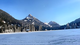
- Views of Pfronten
- Pfronten-Berg
- Ruine Falkenstein
- Engetal with Aggenstein
- Vilstal
Further reading
[change | change source]- Johann B. Doser: Pfronten in Vergangenheit und Gegenwart – Ein Beitr. zur Heimatkunde. Pfronten-Ried 1925
- Simone Haf, Alison Feller: Pfrontener Impressionen. Horb am Neckar 2002. ISBN 3-89570-791-0
- Ludwig Holzner: Geschichte der Gemeinde Pfronten. herausgegeben von der Gemeinde Pfronten 1956
- Anton H. Konrad, Annemarie Schröppel, Adolf Schröppel: Pfronten (Schwäbische Kunstdenkmale, 34). Weissenhorn 1986
- Pfrontener Bilderbogen 86. Pfronten 1986. ISBN 3-925407-03-0
- Annemarie Schröppel, Adolf Schröppel: Alt-Pfrontener Photoalbum. Pfronten 1984
- Annemarie Schröppel: Pfrontener Kirchen und Kapellen und ihre Pfarrer. Pfronten 2002
- Thaddäus Steiner/Bertold Pölcher/Gemeinde Pfronten (Hrsg.): Pfrontener Flurnamen. Pfronten 2010 ISBN 978-3-00-032977-7
References
[change | change source]- ↑ Liste der ersten Bürgermeister/Oberbürgermeister in kreisangehörigen Gemeinden, Bayerisches Landesamt für Statistik, 15 July 2021.
- ↑ Genesis Online-Datenbank des Bayerischen Landesamtes für Statistik Tabelle 12411-003r Fortschreibung des Bevölkerungsstandes: Gemeinden, Stichtag (Einwohnerzahlen auf Grundlage des Zensus 2011) .
Other websites
[change | change source]![]() Media related to Pfronten at Wikimedia Commons
Media related to Pfronten at Wikimedia Commons
- Official website
 (in German)


 French
 Deutsch


