Sunshine Coast, Queensland - Simple English Wikipedia, the free encyclopedia
| Sunshine Coast Queensland | |||||||||
|---|---|---|---|---|---|---|---|---|---|
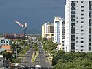
| The Glass House Mountains from Mary Cairncross Reserve; Hastings Street at Noosa Heads, Maroochydore's urban centre; Rainbow Beach, Currimundi Beach in Caloundra; The Big Cow in Nambour, Steve Irwin at Australia Zoo | |||||||||
 | |||||||||
| Coordinates | 26°39′S 153°04′E / 26.650°S 153.067°E | ||||||||
| Population | 302,122 (2015)[1] (9th) | ||||||||
| • Density | 185.01/km2 (479.2/sq mi) | ||||||||
| Area | 1,633 km2 (630.5 sq mi)[2] (2011 urban) | ||||||||
| Location | 100 km (62 mi) from Brisbane | ||||||||
| LGA(s) | |||||||||
| State electorate(s) | Buderim, Caloundra, Glass House, Kawana, Maroochydore, Nicklin, Noosa | ||||||||
| Federal division(s) | |||||||||
| |||||||||
The Sunshine Coast (population 312,908) is a coastal region in South East Queensland, north of the Queensland capital of Brisbane. On 15 March 2008, the former Councils of Noosa Shire, Maroochy Shire and Caloundra City combined to form the Sunshine Coast Regional Council.
The Sunshine Coast is bordered by the Pacific Ocean in the east, and extends to the local government boundaries beyond the Blackall Range to the west. Sometimes, the towns of Gympie, which is 30 minutes' drive north of Noosa Heads, and Caboolture, 30 minutes' drive south of Caloundra, have been included in a broader definition of the Sunshine Coast region.
History
[change | change source]The Glass House Mountains, located south-west of Caloundra, were first sighted by James Cook from the deck of the HM Bark Endeavour in 1770.
The Sunshine Coast's first white inhabitants were three castaways who shared the life of the aborigines for eight months. Later it became the home of many runaway convicts. It was also the scene of some of the most bitter skirmishes of Australia's Black War.
Timber-getters used its rivers and lakes as seaways to float out logs of cedar, and prospectors climbed its mountains to reach the Gympie gold. With the coming of the railway line to Gympie, the coastal towns, which were founded as ports for the early river trade, were bypassed. The Sunshine Coast later grew into a holiday destination, which was further expanded in the development boom of the 1960s and 1970s.[3]
Tourism
[change | change source]The Sunshine Coast is a centre for tourism. The attractions include: Steve Irwin's Australia Zoo, UnderWater World marine park, Aussie World with the Ettamogah Pub, The Buderim Ginger Factory, The Big Pineapple and the Majestic Theatre at Pomona.
The Sunshine Coast contains many beaches. Many well-known beaches within the Sunshine Coast region are located at Noosa Heads, Alexandra Headland, Mooloolaba (the spit), Coolum, Maroochydore and Kings Beach in Caloundra.
The region is also home to more national parks than any other region in Queensland.[4] The natural variety of the area has been protected by five separate parks in both coastal and inland regions, including Mapleton Falls National Park, Kondalilla National Park, The Glasshouse Mountains National Park, Noosa National Park, and the Great Sandy National Park, which includes sections on Fraser Island and in Cooloola near Rainbow Beach.
References
[change | change source]- ↑ "3218.0 – Regional Population Growth, Australia, 2014–15: Population Estimates by Significant Urban Area, 2005 to 2015". Australian Bureau of Statistics. Australian Bureau of Statistics. 30 March 2016. Archived from the original on 8 September 2016. Retrieved 12 September 2016. Estimated resident population, 30 June 2015.
- ↑ "2011 Census Community Profiles: Sunshine Coast". ABS Census. Australian Bureau of Statistics. Archived from the original on 7 November 2017. Retrieved 15 September 2016.
- ↑ "Queensland Government Profile of the Sunshine Coast". Archived from the original on 13 February 2007. Retrieved 20 August 2010.
- ↑ "Sunshine Coast Australia.com National Parks Section". Archived from the original on 28 August 2006. Retrieved 20 August 2010.


 French
 Deutsch


