Lezhë prefektur – Wikipedia
| Lezhë prefektur | |
| Lezhë, Qarku Lezhe | |
| Prefektur | |
| Land | |
|---|---|
| Höjdläge | 92 m ö.h. |
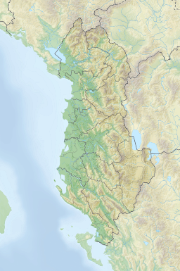
| Koordinater | 41°48′00″N 19°52′00″Ö / 41.8°N 19.86667°Ö |
| Lezha | |
| Area | 1 620,00 km² |
| Folkmängd | 134 027från enwiki |
| Befolkningstäthet | 83 invånare/km² |
| Tidszon | CET (UTC+1) |
| - sommartid | CEST (UTC+2) |
| ISO 3166-2-kod | AL-08 |
| Geonames | 3344949 |
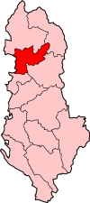
Lezha prefektur (alb. Qarku i Lezhës) är en av Albaniens tolv prefekturer.[1] Den bestod fram till 2014 av distrikten distrikten Kurbin, Lezhë, och Mirditë med Lezha som residensstad.[2]
Lezhë prefektur består sedan 2014 av kommunerna Kurbin, Lezhë, Mirditë.[3]
Andra orter i Qarku i Lezhës är Kurbnesh, Laç, Mamurras, Milot, Rrëshen, Rubik och Shëngjini .
| Kommuner | Admistrativa enheter i kommunen | Tidigare distrikt |
|---|---|---|
| Kurbin | Fushë-Kuqejë, Laç, Mamurras, Milot | Kurbin |
| Lezhë | Balldren i Ri, Blinisht, Dajç, Kallmet, Kolsh, Lezhë, Shëngjin, Shënkoll, Ungrej, Zejmen | Lezhë |
| Mirdita | Fan, Kaçinar, Kthella, Orosh, Rrëshen, Rubik, Selita | Mirditë |
Källor
[redigera | redigera wikitext]- ^ Qarku i Lezhës at GeoNames.Org (cc-by); post uppdaterad 2015-04-21; databasdump nerladdad 2015-05-09
- ^ Allison Dolan (2014) (på engelska). The Family Tree Historical Maps Book: A State-by-State Atlas of US History, 1790-1900.
- ^ Zachariah H Claybaugh (2019) (på engelska). A Research Guide to Southeastern Europe : Print and Electronic Sources.
- ^ ”FLETORJA ZYRTAREE REPUBLIKËS SË SHQIPËRISË”. sid. 6373. https://web.archive.org/web/20150924085559if_/http://www.reformaterritoriale.al/images/presentations/Ligji%20ndarja%20territoriale_Fletore_zyrtare.pdf. Läst 27 april 2022.
| |||||


 French
 Deutsch

