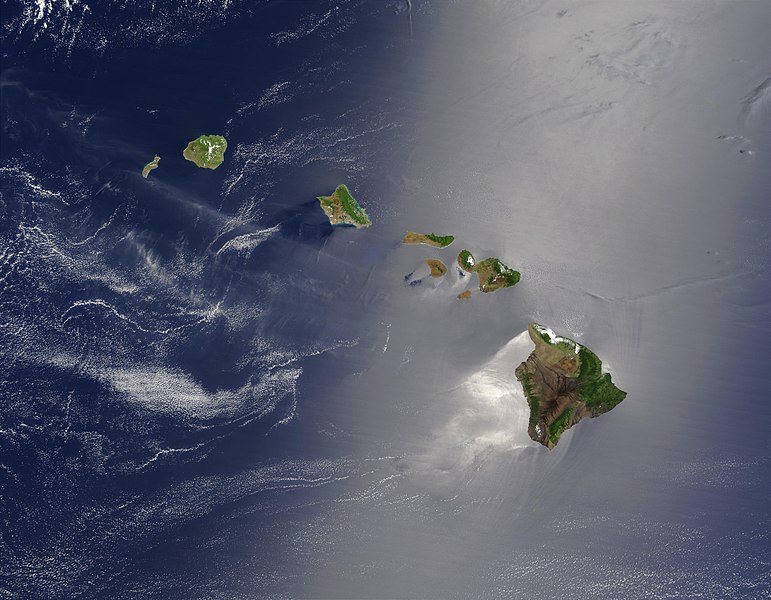
Dosya:Hawaje-NoRedLine.jpg - Vikipedi

Bu önizlemenin boyutu: 771 × 600 piksel. Diğer çözünürlükler: 309 × 240 piksel | 617 × 480 piksel | 988 × 768 piksel | 1.280 × 996 piksel | 2.560 × 1.991 piksel | 3.600 × 2.800 piksel.
Tam çözünürlük ((3.600 × 2.800 piksel, dosya boyutu: 2,81 MB, MIME tipi: image/jpeg))
Dosya geçmişi
Dosyanın herhangi bir zamandaki hâli için ilgili tarih/saat kısmına tıklayın.
| Tarih/Saat | Küçük resim | Boyutlar | Kullanıcı | Yorum | |
|---|---|---|---|---|---|
| güncel | 22.24, 1 Eylül 2010 |  | 3.600 × 2.800 (2,81 MB) | IdLoveOne~commonswiki | {{RetouchedPicture|cloned out and healed little red line on the big island|editor=IdLoveOne|orig=Hawaje.jpg}} {{self|PD-USGov-NASA}} == {{Original upload log}} == This image is a derivative work of the following images: *File:Hawaje.jpg licensed w |
Dosya kullanımı
Bu görüntü dosyasına bağlantısı olan sayfalar:
Küresel dosya kullanımı
Aşağıdaki diğer vikiler bu dosyayı kullanır:
- ace.wikipedia.org üzerinde kullanımı
- af.wikipedia.org üzerinde kullanımı
- als.wikipedia.org üzerinde kullanımı
- ar.wikipedia.org üzerinde kullanımı
- ary.wikipedia.org üzerinde kullanımı
- arz.wikipedia.org üzerinde kullanımı
- ast.wikipedia.org üzerinde kullanımı
- azb.wikipedia.org üzerinde kullanımı
- az.wikipedia.org üzerinde kullanımı
- ba.wikipedia.org üzerinde kullanımı
- be-tarask.wikipedia.org üzerinde kullanımı
- be.wikipedia.org üzerinde kullanımı
- bh.wikipedia.org üzerinde kullanımı
- bn.wikipedia.org üzerinde kullanımı
- bn.wikibooks.org üzerinde kullanımı
- bn.wikivoyage.org üzerinde kullanımı
- ca.wikipedia.org üzerinde kullanımı
- ceb.wikipedia.org üzerinde kullanımı
- crh.wikipedia.org üzerinde kullanımı
- cs.wikipedia.org üzerinde kullanımı
- cv.wikipedia.org üzerinde kullanımı
- cy.wikipedia.org üzerinde kullanımı
- dag.wikipedia.org üzerinde kullanımı
- de.wikipedia.org üzerinde kullanımı
- diq.wikipedia.org üzerinde kullanımı
- el.wikipedia.org üzerinde kullanımı
- en.wikipedia.org üzerinde kullanımı
Bu dosyanın daha fazla küresel kullanımını görüntüle.


 French
 Deutsch


