
 French
 Deutsch
Файл:Sahara dust plume Nov 1998.jpg — Вікіпедія

Розмір при попередньому перегляді: 800 × 567 пікселів. Інші роздільності: 320 × 227 пікселів | 640 × 454 пікселів | 1024 × 726 пікселів | 1280 × 908 пікселів | 2560 × 1816 пікселів | 4449 × 3156 пікселів.
Повна роздільність (4449 × 3156 пікселів, розмір файлу: 5,06 МБ, MIME-тип: image/jpeg)
| Відомості про цей файл містяться на Вікісховищі — централізованому сховищі вільних файлів мультимедіа для використання в проектах Фонду Вікімедіа. |
Опис файлу
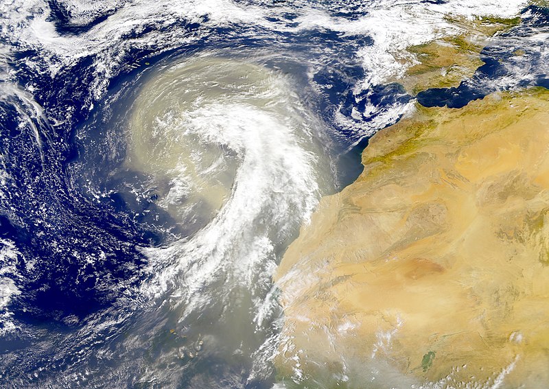
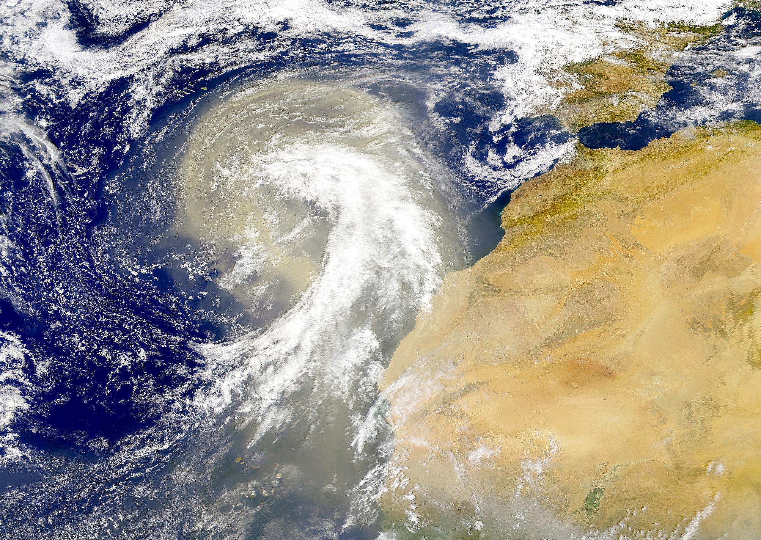
| Опис | Dust plume off the Sahara desert over the northeast Atlantic Ocean. The Azores are visible at the northwest edge of the dust plume in this SeaWiFS image. The Cape Verde Islands can be seen through the dust near the bottom of the image. Sensor: OrbView-2/SeaWiFS |
| Час створення | |
| Джерело | NASA Visible Earth |
| Автор | Provided by the SeaWiFS Project, NASA/Goddard Space Flight Center, and ORBIMAGE |
Ліцензування
| This image is from the Sea-viewing Wide Field-of-view Sensor (SeaWiFS) Project and more than 5 years old. Satellite data captured by the SeaWIFS sensor are released into the public domain 5 years after capture. Data less than five years old can be re-used only for educational or scientific purposes; any commercial use of such images must be coordinated with GeoEye. [1] |
| This work has been released into the public domain by its copyright holder, GeoEye. This applies worldwide. У деяких країнах це не може бути юридично можливо, в такому випадку: GeoEye дає кожному право на використання цієї роботи для будь-яких цілей, без будь-яких умов, якщо такі умови не вимагаються за законом.
|
Історія файлу
Клацніть на дату/час, щоб переглянути, як тоді виглядав файл.
| Дата/час | Мініатюра | Розмір об'єкта | Користувач | Коментар | |
|---|---|---|---|---|---|
| поточний | 00:01, 6 листопада 2005 | | 4449 × 3156 (5,06 МБ) | Tintazul | {{Information| |Description=Dust plume off the Sahara desert over the northeast Atlantic Ocean. The Azores are visible at the northwest edge of the dust plume in this SeaWiFS image. The Cape Verde Islands can be seen through the dust near the bottom of th |
Використання файлу
Такі сторінки використовують цей файл:
Глобальне використання файлу
Цей файл використовують такі інші вікі:
- Використання в ar.wikipedia.org
- Використання в ast.wikipedia.org
- Використання в azb.wikipedia.org
- Використання в ca.wikipedia.org
- Використання в en.wikipedia.org
- Використання в en.wikivoyage.org
- Використання в eo.wikipedia.org
- Використання в es.wikipedia.org
- Використання в fa.wikipedia.org
- Використання в ga.wikipedia.org
- Використання в hu.wikipedia.org
- Використання в ko.wikipedia.org
- Використання в lt.wikipedia.org
- Використання в lv.wikipedia.org
- Використання в ml.wikipedia.org
- Використання в vi.wikipedia.org
- Використання в www.wikidata.org