
 French
 Deutsch
File:The Ghan route map.png - 维基百科,自由的百科全书

本预览的尺寸:650 × 600像素。 其他分辨率:260 × 240像素 | 520 × 480像素 | 832 × 768像素 | 1,109 × 1,024像素 | 1,300 × 1,200像素。
原始文件 (1,300 × 1,200像素,文件大小:285 KB,MIME类型:image/png)
摘要
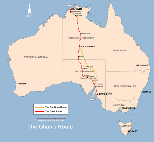
| 描述 | English: The Ghan route map created by Bidgee based on other Ghan route maps on the internet which are low resolution and are not free to use . |
| 日期 | |
| 来源 | 自己的作品 |
| 作者 | Bidgee |
| 其他版本 |  |
许可协议
我,本作品著作权人,特此采用以下许可协议发表本作品:
本文件采用知识共享署名 3.0 未本地化版本许可协议授权。
- 您可以自由地:
- 共享 – 复制、发行并传播本作品
- 修改 – 改编作品
- 惟须遵守下列条件:
- 署名 – 您必须对作品进行署名,提供授权条款的链接,并说明是否对原始内容进行了更改。您可以用任何合理的方式来署名,但不得以任何方式表明许可人认可您或您的使用。
文件历史
点击某个日期/时间查看对应时刻的文件。
| 日期/时间 | 缩略图 | 大小 | 用户 | 备注 | |
|---|---|---|---|---|---|
| 当前 | 2008年12月2日 (二) 11:38 | | 1,300 × 1,200(285 KB) | Bidgee | Fix scale (Upload take 42) |
| 2008年12月2日 (二) 11:36 |  | 1,300 × 1,200(288 KB) | Bidgee | Reverted to version as of 19:22, 13 June 2008 | |
| 2008年12月2日 (二) 10:57 | 没有缩略图 | (285 KB) | Bidgee | Fix scale. | |
| 2008年6月13日 (五) 19:22 |  | 1,300 × 1,200(288 KB) | Bidgee | Update {{ImageUpload|basic}} | |
| 2008年5月20日 (二) 09:39 |  | 1,200 × 1,121(491 KB) | Bidgee | Correcting font sizes | |
| 2008年5月20日 (二) 09:06 |  | 1,200 × 1,121(486 KB) | Bidgee | fix state and territory borders. | |
| 2008年5月20日 (二) 08:15 |  | 1,200 × 1,121(415 KB) | Bidgee | Image fix | |
| 2008年5月20日 (二) 07:55 |  | 1,200 × 1,121(415 KB) | Bidgee | {{Information |Description=The Ghan route map created by Bidgee based on other Ghan route maps on the internet which are low resolution and are not free to use. |Source=self-made |Date=20th May 2008 |Author= Bidgee |Permiss |
文件用途
以下页面使用本文件:
全域文件用途
以下其他wiki使用此文件:
- ca.wikipedia.org上的用途
- en.wikipedia.org上的用途
- en.wikivoyage.org上的用途
- es.wikipedia.org上的用途
- fi.wikipedia.org上的用途
- fr.wikipedia.org上的用途
- hi.wikipedia.org上的用途
- hu.wikipedia.org上的用途
- it.wikipedia.org上的用途
- ja.wikipedia.org上的用途
- ko.wikipedia.org上的用途
- ml.wikipedia.org上的用途
- nl.wikipedia.org上的用途
- pl.wikipedia.org上的用途
- simple.wikipedia.org上的用途
- sv.wikipedia.org上的用途
- www.wikidata.org上的用途